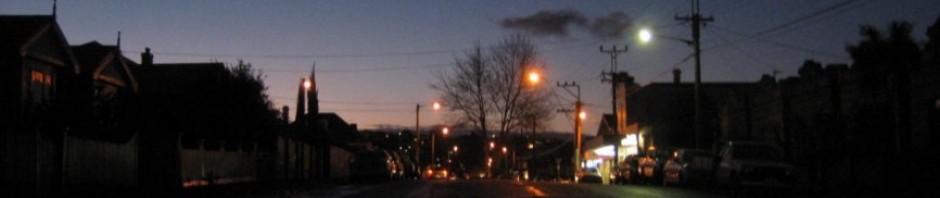
So you’v e just arrived in your rocket ship from outer space and it has plonked you in West Hobart.
It certainly looks a reasonable place to set up camp; but what’s here and how do you find things? You must have a host of unanswered questions.
- Where do I get food and what’s available?
- Where should I live?
- Which night is rubbish collected?
- Is there a school nearby?
- Are there any baby-sitters?
- How often do buses run?
- What community organisations exist?
- Where is there a doctor?
- What is that building?
- What used to be here?
- Where are the parks?
- Who else is interested in basket weaving?
- Where do I get petrol?
- Are there any good restaurants?
And so the list could go on.
This web site is being set up to allow information about West Hobart to be shared.
There is so much history about West Hobart but where does one go to access it easily?
This is what the real estate industry say about West Hobart
There are so many stories about residents past and present which deserve to be recorded for posterity. Unless a start is made soon, it may well be too late and the opportunity may disappear.
If you have an idea for recording our history, some expertise to offer or a suggestion to make the whole ordeal simpler we’d really appreciate your contribution.
Topics might include
- The old K&D Brick Works at the top of Arthur St
- Rory Jack’s escapades – old paper clippings and links to more information
- Various parks in the suburb
- Special interest Groups in West Hobart eg WHEN, NHW, Scouts, craft etc.
- Successful Businesses
Just drop me a line at paul.turvey@gmail.com or send me a message in the “reply” box below.

The cemetery which used to be bounded by Hill Street, Adelaide Street, and Butterworth Street should rate a mention. It operated from 1840 until Cornelian Bay opened in 1872.
The number 32 tram that ran prior to the Great War is probably worthy of comment as well
I have an index of burials for the Hill St Wesleyan cemetery that was published a few years ago and was compiled by Rosemary Davidson.
As I was brought up in Hamilton Street, my mother told us about the cemetery, the idea of a burial ground just down the road was fasinating, but the idea of the houses being built on the ground was a bit scary to a youngster!. I think some of the headstones were put into the park in Melifont Street.
Helen
Hi Helen, My GGGGM Francis Mary Conliffe born C 1787 before the First Fleet sailed was buried Hill St, 31 Jan 1852. Was her husband John Conliffe buried in the same cemetery? He died 27 June 1854 at Hobart Town aged about 71.
Is there a 12 day old male Conliffe, born 14 Sept 1854 also there?
Would be grateful for your assistance.
Kind regards, Brian.
Frances Mary Conliffe died on 28 January 1852 age 65. She was described as a widow of a carpenter. The informant was George Flexmore of Sandy Bay who was described as a friend but I suspect was a relative.. I can find no record of John’s death or burial. The death of an unnamed male child on 14 September 1854 is recorded but there is no record of a burial at Hill Street. He could have been the child of Charles Conliffe & Elizabeth nee Flexmore
Hi Helen,
If you still drop in to this site now and then we’d love a copy of the list! Esp. if it has a map and plot locations linked to names.
We’ve found a list of the 14 people removed and taken to Cornelian Bay between 1873 and 1886 but would love to know who was left behind.
Where can I find a list of these 14 people or are you able to FWD it. Thanks
Hi Chris,
Here’s the list of removed remains from Wesleyan Burial Ground. Pp 42-43 online, or 5-6 printed.
http://stors.tas.gov.au/1126143
Cheers, Adam
Thanks Adam. That’s great. Do you know the origin of the listings. Was it done by Cornelian Bay or others. The areas (BB, L, and H) are all located between Hobart Road and Brighton Street within the cemetery and in the Wesleyan and United Methodist area. I know at least some of the names are from prominent families and I would suggest they arranged for the remains to be removed to the new cemetery as Hill Street was becoming quite neglected.
No idea other than the next level up in the database. – http://search.archives.tas.gov.au/default.aspx?detail=1&type=S&id=AF171 – We were really only interested in the Wesleyan end to try and find out who we have in our frontyard. We’ve named him or her Milly after the ghost down at the Drunken Admiral as it seems the jaw was from a child and we wanted to be able to say hello on a personal level.
We’ve found a copy in the Hobart library of Rosemary Davidson’s book so hopefully it will include a map linked to names and plot numbers once we see it in person.
https://linctas.ent.sirsidynix.net.au/client/en_AU/all/search/results?qu=burials+wesleyan+burial+ground#
I have the plan of the cemetery if you can give me some idea of the precise l;ocation of your home or better stil the spot where the skull was found. Have the powers that be given any indication of the age of the child? I can look on my plan but I think it is still needle in the haystack stuff
Hi Chris,
General concensus on the age – although this is from armchair experts on reddit so should be taken with a grain of salt – is that the jaw was from a child or teen. It was definitely a small set of teeth, so it fits in with what we thought as well.
Our house is the second one up from Hamilton St towards Arthur St. We popped into the library today and got hold of a map of the cemetery and think we’d probably be in the J section. It’s hard to judge as the map didn’t have a scale and we’re not sure what the road was like when the cemetery was here. Do you have any idea if it was narrower, meaning the location of the remains found would have been further away from the road as they appear now? They were found in the front of the house, under the chimney…
We’ve found a grave in our presumed section of a 10 year old girl named Emma, and also her six year old sister. We’re thinking it might be Emma but would love to hear your more learned suggestions!
Date: Wed, 17 Feb 2016 10:54:13 +0000 To: introverse@hotmail.com
I think we can only assume that the fence line was in the same location then as now. How far is your chimney from Hamilton Street and/or Arthur Street? How far is the chimney set back from the Hill Street fence line? Measurements in metres, feet, inches or links are O.K. as long as you tell me which!! I’m not sure that my suggestions are more learned but I’ll see what I can come up with.
Hi Chris,
Sorry we’ve taken so long to get back to you. I’ll dig out the tape measure tomorrow and find out the reference points for you from Hamilton St (used to be Adelaide St?) and Hill St to our chimney.
Fingers crossed we can find a name – we’d love to set up a little memorial over the grave or eventually rename the house in his or her honour with the original name in brackets.
Date: Fri, 19 Feb 2016 08:48:45 +0000 To: introverse@hotmail.com
Hi Chris,
I could only find a silly little metre long tape measure, but it measures 7.5m from our Hill Street front fence and 6m from the Arthur Street side side fence to the spot where the skull was, which forms the two borders of the cemetery on the maps.
Hope that helps!
From: introverse@hotmail.com To: comment+egb3mrlqt_fj6_nl8c0a8m-ctbirmgelv6b2iwnldrq2r@comment.wordpress.com Subject: RE: [New comment] Welcome to West Hobart Date: Sat, 27 Feb 2016 02:09:44 +1100
Hi Chris,
Sorry we’ve taken so long to get back to you. I’ll dig out the tape measure tomorrow and find out the reference points for you from Hamilton St (used to be Adelaide St?) and Hill St to our chimney.
Fingers crossed we can find a name – we’d love to set up a little memorial over the grave or eventually rename the house in his or her honour with the original name in brackets.
Date: Fri, 19 Feb 2016 08:48:45 +0000 To: introverse@hotmail.com
I reckon we have the scale all wrong. We’re still in the mindset that the burial ground covered the whole block, and it seems to have been only in the corner. I’d put us a G or K – what do you think?
From: introverse@hotmail.com To: comment+egb3mrlqt_fj6_n_nhj76abqqqr42bohi34a0l9hyfh3i@comment.wordpress.com Subject: RE: [New comment] Welcome to West Hobart Date: Thu, 18 Feb 2016 16:22:40 +1100
Hi Chris,
General concensus on the age – although this is from armchair experts on reddit so should be taken with a grain of salt – is that the jaw was from a child or teen. It was definitely a small set of teeth, so it fits in with what we thought as well.
Our house is the second one up from Hamilton St towards Arthur St. We popped into the library today and got hold of a map of the cemetery and think we’d probably be in the J section. It’s hard to judge as the map didn’t have a scale and we’re not sure what the road was like when the cemetery was here. Do you have any idea if it was narrower, meaning the location of the remains found would have been further away from the road as they appear now? They were found in the front of the house, under the chimney…
We’ve found a grave in our presumed section of a 10 year old girl named Emma, and also her six year old sister. We’re thinking it might be Emma but would love to hear your more learned suggestions!
Date: Wed, 17 Feb 2016 10:54:13 +0000 To: introverse@hotmail.com
We had this little bit of macabre excitement happen in our front yard on Hill Street this morning…
http://www.abc.net.au/news/2016-02-12/human-remains-found-in-west-hobart-front-yard/7162822
It was claimed that all the remains had been removed to Cornelian Bay prior to 23 August 1927. Someone was clearly telling porkies!. The very last burial was in 1874 so your skull has to be at least 142 years old
What a great idea, Paul! I have done something similar with a wiki about Sorell but have done it with students from the school doing the research and inputting the data. Interviewing residents and taken photos is one way students could be involved in this as part of their History courses. Here is a link to our wiki. https://sorelltas.wikispaces.com/
This looks great,Paul. Can you make the link to WHEN go straight to our homepage? Thanks!
Hi Di,
I think I’ve finally managed to make it work!
Hope to catch up soon.
Cheers
Paul
I think you’ll find that the park in Melifont Street has some connection with a burial ground for the Society of Friends commonly known as the Quakers. Rosemary’s book about the Hill Street Burial Ground makes it fairly clear that there are probably human remains still under the houses that never made it to Cornelian Bay
Great to meet another Tasmanian blogger 🙂 Looking forward to getting to know more about West Hobart 🙂
Hi!
What a varied history! Students at Goulburn Street Primary love the photo of the trams going past the St John Baptist Church on Goulburn street and we were wondering if anyone knows roughly when this photo was taken? Or who by.
Thanks
Sophy.
What about the old burial ground on the corner of Hamilton Street & Hill Street. How many of those houses on that site literally have skeletons in their gardens???
There was a dairy farm at top end of Hamilton Street near the school oval. Ayers bus service operated from Lansdowne Crescent and there was a kindergarten in Hamilton street where the units are built now.
Correct Judy. That was my Grandfather Roland Edward Steele Jr who would graze his 40 cows near there or Elaine Crescent off Arthur Street. 20 would be milked in the morning and the rest in the afternoon. It was originally ran by his Father Roland Steele Sr. Roland Jr was originally an Electrical Engineer at the Tramways but during the depression left to takeover the business as there was more certainty in milk, something everyone needed everyday. His delivery round serviced most of West Hobart. It’s thought he stepped down from the business in maybe 1948 or into the mid fifties. After a short break he took over the corner store on Hill St and Lansdowne Crescent which is now the Chemist Shop. He retired from there in maybe the late 60’s or early 70’s.
Hello, I have recently been trying to research some history on the area of West Hobart that includes Forrest Road and William and Frederick Streets, the property that is now 25 William Str (Formerly 24 Frederick Street) Use to house a pneumatic organ which is now in the little church in Swan Str, North Hobart. I am wondering if anyone knows if Forrest Road was named after Haugton Forrest and if anyone has any information on the above property? It was built circa 1886 By Colonel A J Reid and is a lovely Victorian weatherboard house with three bay windows, a steep pitched roof and sandstone foundations.
I believe that Frederick William Corby may have been the original land owner of this area of West Hobart, or was at least associated with it in some way, as the streets bear his name.
Um, it’s Forest Rd, isn’t it?
Sorry, I know nothing about your other interesting questions.
I just Google mapped it and you are correct. There goes that theory, but thank you for your knowledge and observation skills. Clearly they are better than mine.
Donald Howatson records in his book “The Story of West Hobart – Street by Street”, published February 2014, that the name of Forest Road “is derived from the fact that it provides access to the wooded slopes at the south end of Knocklofty, an area that was originally known as Woodman’s Hill”
Hi, I am trying to find the exact location of a house once owned by Mary Allport called Fairy Knowe. It was located in upper Liverpool street. Can anyone help please.
email to Ian Broinowski ibroinowski@netspace.net.au
Thankyou
Ian
Some very amateur sleuthing has found its sale in The Mercury, Monday 29 June 1903, page 6;
“BURN AND SON
Are instructed by the Trustees to Gell,
at their Mart, Elizabeth-street, on TUESDAY, June 30, at noon,
THAT DESIRABLE RESIDENCE,
No. 335 Liverpool-street, known as
“FAIRY KNOWE,”
for so many years occupied by the late Mr. John Roberts, and until recently by his widow. The house, which contains nine rooms on the ground floor, besides attics, stands on a large piece of land, which has extensive frontages on LIVERPOOL-street, HOPE-street, and GOULBURN-street (Street name emphasis added). The grounds are tastefully laid out in fruit and flower gardens and shrubberies. Both house and grounds are in first-class order. The view from the property over the City and River cannot be excelled.”
I was not familiar with Hope Street, but looking at Sprent’s Book Mosaic on the list.tas.gov.au shows it, as well as the original “smaller” grant to John Roberts. Looking at theList map’s Town Grants Charts also shows this plot AND the change of name for Hope Street to (surprise surprise) Robert Street. So if you imagine the block contained in Forest Road/Goulburn Street (Upper end of Goulburn was renamed Forest Road) , Molle Street, Liverpool Street, and Roberts Street, and divide it into eight squares:
FOREST/
GOULBURN
1 2 3 4
5 6 7 8
LIVERPOOL
John Roberts’ original grant was block 2 but by the time of sale in 1903 in seems from the above description that it expanded to occupy 1, 5, and probably 6 at least.
In the Mercury, Tuesday 17 June 1919, page 3 we read:
“FAIRY KNOWE ESTATE.
This Magnificent Estate is being divided and sold at once.
Only a couple of Blocks left on Liverpool-street.
7 minutes from Walch’s Corner.
On Lovely Sunny Slope. a Magnificent View of Labour and City. Good, Rich Black Soil.
Orchards in full bearing.
Your chance is to act promptly. The Blocking approximately 40 x 125 feet, in ith a right-of-way at back of over 40 foot.
Splendid chance for Investor, Contractor, or Business Men, who must live close to city.
Price, from £7151 per foot. See it To-day.
SCAlUi’S “HAPPY HOME” STORES,
Elizabeth-street. ‘Phono: 502.”
The only building marked on Robert’s original plot on the Sprent Map was where now the boundary lies between 14 and 16 Forest Road, so not existing now.
Hope this helps.
Colin